Today is January 22, 2025
Export PDF

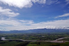
Upper Pulangi Watershed, Bukidnon

Upper Pulangi Watershed, Bukidnon

Address: Bukidnon

Description: As the Philippines’s second largest watershed, Pulangi owns the forests that support the vast Pulangi River Basin, which in turn provides 30% of the total hydropower generated for the whole Mindanao grid. This priority site is also a nesting area of the Philippine eagle (Pithecophaga jefferyi) and ancestral domain of Bukidnon’s Higaonon tribe.

Status: Closed

Site Profile Summary

Ecosystem Types

Lowland Forest

Protection Status

Ancestral Domain (Indigenous Peoples Rights Act (IPRA))

Area

27, 025 hectares

Biogeographic Features

  • It is the Philippine's second largest watershed, covering an area of 1.8 million hectares.

  • Its forests are ecologically important to the vast Pulangi River Basin (a.k.a., Rio Grnade de Mindanao), which supports 30% of total hydro-irrigation requirements of at least 100,000 hectares of rice lands, and the potable water needs of two cities and 22 municipalities in Bukidnon.

Flora

  • It is also known for its dipterocarps (e.g., apitong, lauan and almaciga), pitcher plant, ferns and wild abaca

Fauna

  • It has also been recognized as one of the nesting areas of the critically endangered Philippine Eagle (Pithecophaga jefferyi), and other endangered wildlife including several species of deers, pigs, hornbills, tarsiers, owls, freshwater eels

Livelihood Resources

  • Farming

  • Hunting

Other Matters of Significance

Pulangi is the ancestral domain of the Higaonon tribe of Bukidnon.


Back to Map View
e-News Bulletin Join our mailing list today, and be ready for our next action alert. Enter a valid email address Enter your email address to receive regular news updates and announcements from FPE.